
Table of Contents
- Mgarr ix-Xini to Xlendi: The Southern Cliffs of Gozo
- Xlendi to Dwejra Bay: Trekking the Iconic Limestone Formations
- Dwejra to Wied il-Ghasri: Salt Pans and Scenic Coastal Gorges
- Marsalforn to Ramla Bay: Exploring the Red Sand Shoreline
- Ramla Bay to San Blas: Remote Paths and Hidden Northern Coves
- Embrace the Wild Spirit of Gozo
- Planning Your Coastal Trek
Dust off your boots, fellow explorers!
Gozo, Malta’s rugged sister island, beckons with a coastal embrace that promises more than just picturesque views.
Imagine the salt spray on your face, the scent of wild thyme, and the feel of ancient limestone beneath your feet as you trace paths where Phoenicians once walked.
This isn’t just a hike; it’s an immersive journey into Gozo’s untamed heart.
Beyond the postcards, our meticulously crafted itinerary invites you to uncover the island’s most guarded secrets.
From breathtaking sea arches to serene, untouched coves, each step reveals Gozo’s unique charm and history.
We guide you through a cultural tapestry, ensuring every vista and village stop enriches your understanding.
Consider this your insider’s map, designed to empower both the avid trekker and the curious wanderer.
We’ve balanced exhilarating challenges with moments of quiet reflection, ensuring practical tips meet adventurous spirit.
Prepare to forge unforgettable memories, navigating Gozo’s stunning coastline with confidence, ease, and a deep appreciation for its timeless beauty.
The Explorer’s Brief: Southern Gozo Trails
- Traverse the aromatic plateaus between Mgarr ix-Xini and Xlendi, where the scent of wild thyme blends with the sea salt of the Mediterranean.
- Stand on the edge of the world atop the 130-meter-high Ta’ Ċenċ and Sanap Cliffs, iconic limestone giants that host rare bird species and offer sweeping horizons.
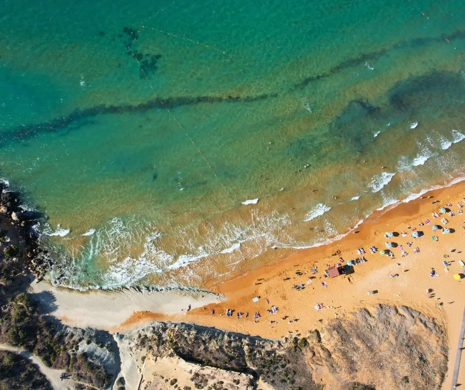
- Descend into the vibrant valley of Xlendi Bay for a refreshing swim and a well-earned meal in a charming, social fishing village atmosphere.
- Navigate the rugged coastal trails with care, prioritizing safety on crumbly limestone edges and preparing for the intense sun with plenty of hydration.
Mgarr ix-Xini to Xlendi: The Southern Cliffs of Gozo
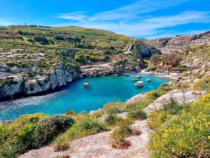
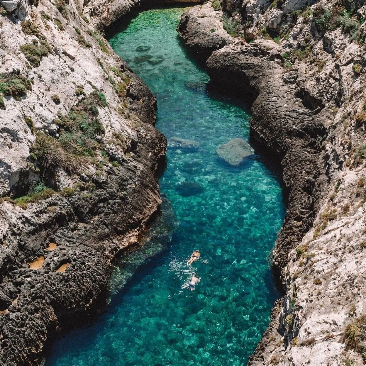
The journey starts at Mgarr ix-Xini. This deep, narrow creek feels like a hidden sanctuary. High cliffs tower over the emerald water below.
You will smell wild thyme and sea salt. The path winds upward toward the high plateau. Every step reveals more of the vast blue horizon.
Walking the southern cliffs of Gozo feels like standing at the edge of the world, where the blue sea meets the sky.
🌲 Mgarr ix-Xini
Free
Hidden Sanctuary: A deep, narrow creek with emerald waters surrounded by high towering cliffs.
- Emerald green waters
- Secluded creek atmosphere
- Wild thyme and sea salt aromas
The Majestic Ta’ Ċenċ Cliffs
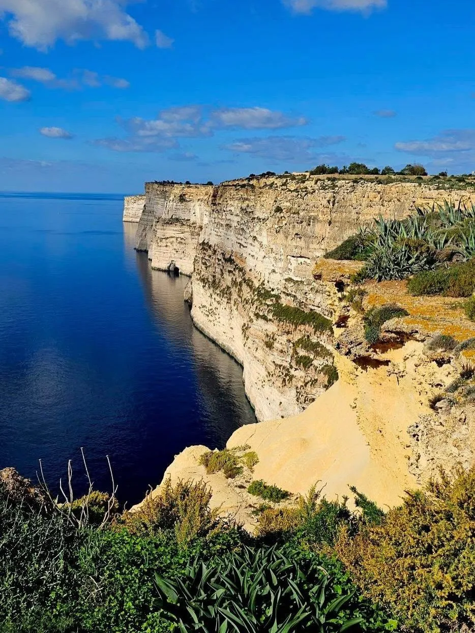
The Ta’ Ċenċ cliffs are the highest on the island. They rise 130 meters above the crashing waves. Look for rare birds nesting in the rocky crags.
Safety is vital near these steep limestone edges. Stay on the marked paths at all times. The wind can be strong and unpredictable here.
Gozo’s southern coast is a dramatic landscape where massive vertical cliffs rise abruptly from the Mediterranean.
VisitGozo, Official Tourism Portal of Gozo
Planning a hike to Wat Pha Lat offers shade, but Gozo offers pure sun. Pack plenty of water and a wide hat for protection.
🌲 Ta’ Ċenċ Cliffs
Free
Highest Island Cliffs: Massive vertical limestone cliffs rising 130 meters above the Mediterranean Sea.
- 130-meter high limestone edges
- Rare nesting birds
- Dramatic panoramic sea views
Descending into Xlendi Bay
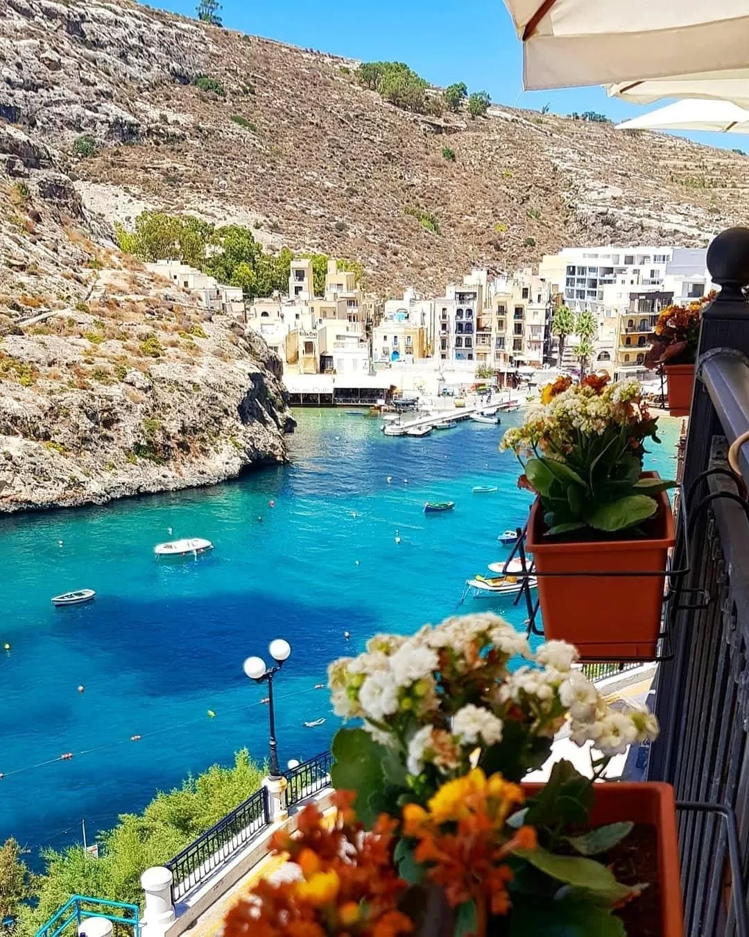
The trail eventually slopes down toward Xlendi. This charming village sits in a lush valley. It is the perfect place for a post-hike meal.
If you are driving to the start, check your summer car essentials first. Parking near Mgarr ix-Xini is limited and quite narrow.
| Feature | Mgarr ix-Xini | Xlendi Bay |
|---|---|---|
| Atmosphere | Quiet and Secluded | Lively and Social |
| Dining Options | Very Limited | Plentiful |
| Swimming | ✅ | ✅ |
The sound of the sea follows you all day. The southern cliffs offer a raw, authentic experience. It is a true highlight for any restless spirit.
Edge of the World: A Gozo Cliffside Trek
- Experience the dramatic 130-meter vertical drops of the Ta’ Ċenċ cliffs, which serve as a habitat for rare nesting birds.
- Prioritize safety by sticking to marked paths to navigate steep limestone edges and unpredictable coastal winds.
- Contrast the quiet, secluded atmosphere of Mgarr ix-Xini with the lively dining scene and social hub of Xlendi Bay.
- Prepare for high sun exposure and limited shade by packing essential supplies like water and wide-brimmed hats.
🍽️ Xlendi Bay
$
Charming Coastal Village: A lush valley village offering a lively atmosphere and numerous post-hike dining options.
- Plentiful dining and seafood options
- Swimming in emerald waters
- Lively and social village square
Xlendi to Dwejra Bay: Trekking the Iconic Limestone Formations
The journey begins in the emerald waters of Xlendi Bay. Here, steep cliffs cradle a small fishing village. The scent of salt and grilled fish fills the air.
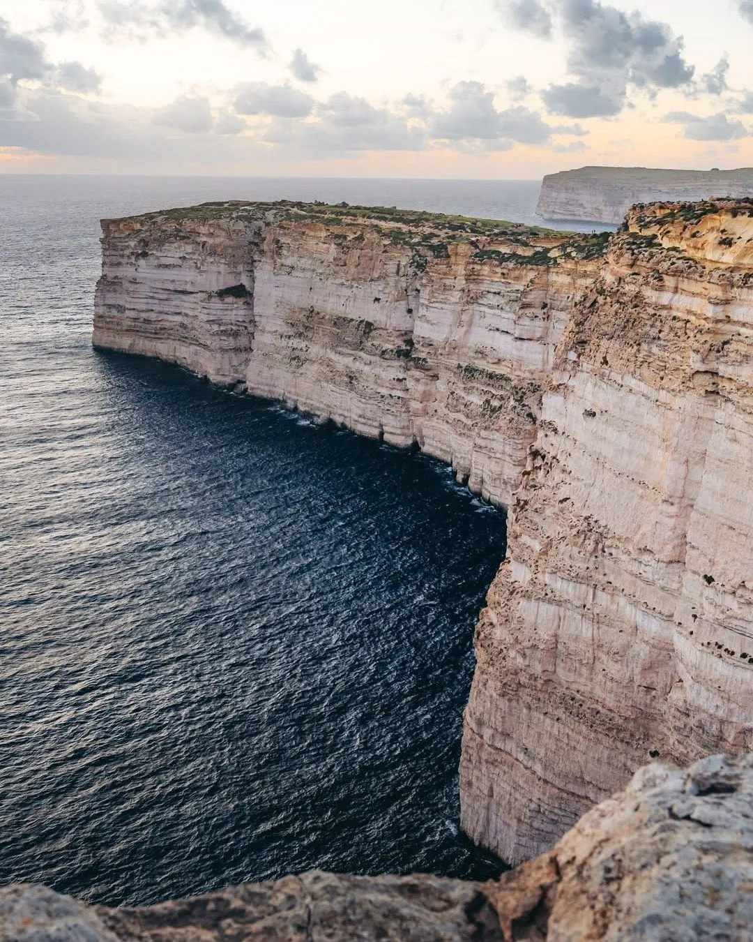
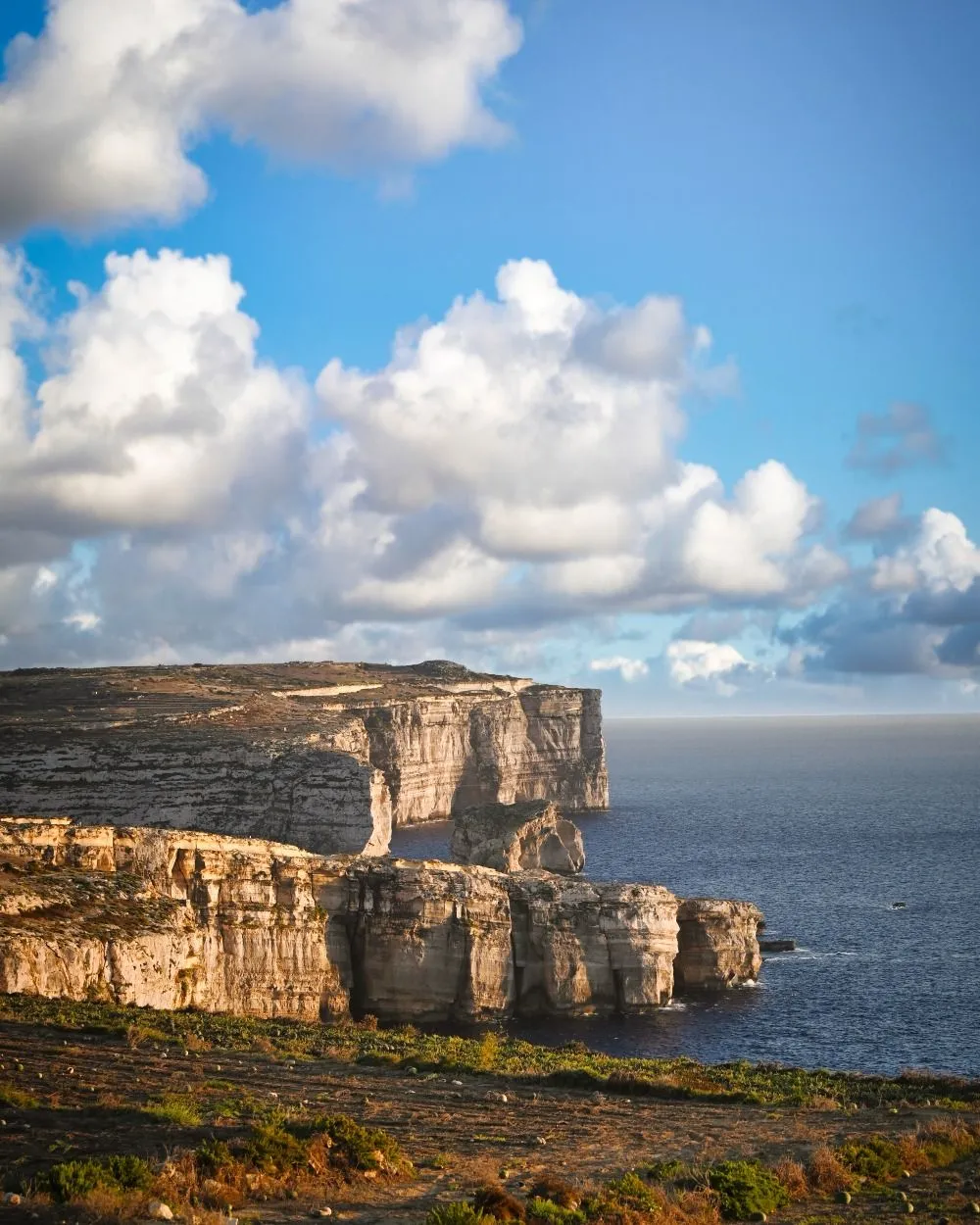
Step onto the rugged trail heading west. You will ascend toward the Sanap Cliffs. These limestone giants tower 130 meters above the crashing Mediterranean waves.
The path is narrow and follows the very edge of the island. The sound of the wind is constant here. Be careful as the limestone can be crumbly and unstable.
Proper preparation is key for these remote paths. Just as you might research the best time to visit the Dolomites for hiking, check local Gozo weather before starting.
Gozo’s western cliffs are where the silence of the island meets the raw power of the Mediterranean sea.
🌲 Sanap Cliffs
Free
Vertical Limestone Giants: Towering coastal cliffs reaching 130 meters high with narrow, dramatic walking paths.
- Raw Mediterranean sea power views
- Narrow clifftop walking paths
- Unstable and ancient limestone formations
Leg 1
Xlendi to Sanap Cliffs
2.0 km walk featuring vertical cliff views.
Leg 2
Sanap to Ta’ Sarraflu
1.5 km walk to find the natural freshwater pond.
Leg 3
Sarraflu to Dwejra Bay
2.0 km final push to the Inland Sea and rock formations.
Navigating the Ta’ Sarraflu Heights
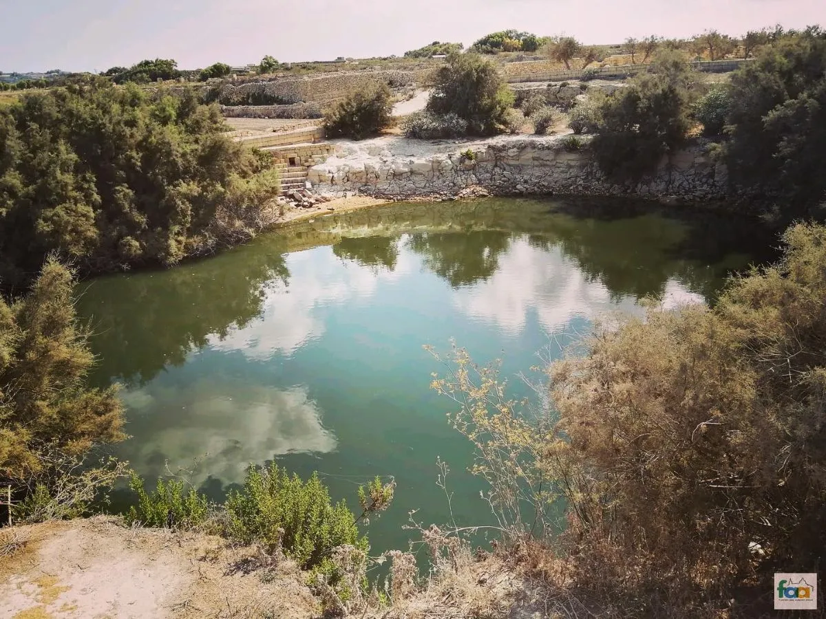
Leave the cliff edge briefly to find Ta’ Sarraflu. This is one of the few natural freshwater ponds on the island. It offers a lush contrast to the dry coast.
Ducks and frogs often inhabit this quiet oasis. It is a perfect spot to rest before the final push. Ensure you carry at least two liters of water for this leg.
The trail continues through rocky garigue terrain. Look for wild thyme and sea chamomile growing between the stones. These plants release a sweet aroma under the hot sun.
The stretch between Xlendi and Dwejra offers some of the most dramatic cliff scenery and geological features in the entire Mediterranean region.
Erik, Malta Uncovered Guide
🌲 Ta’ Sarraflu
Free
Natural Freshwater Pond: One of Gozo’s rare natural freshwater ponds acting as a lush oasis in the dry landscape.
- Resident ducks and frogs
- Lush green contrast to the coast
- Quiet rest spot for hikers
Reaching the Dwejra Geological Wonderland
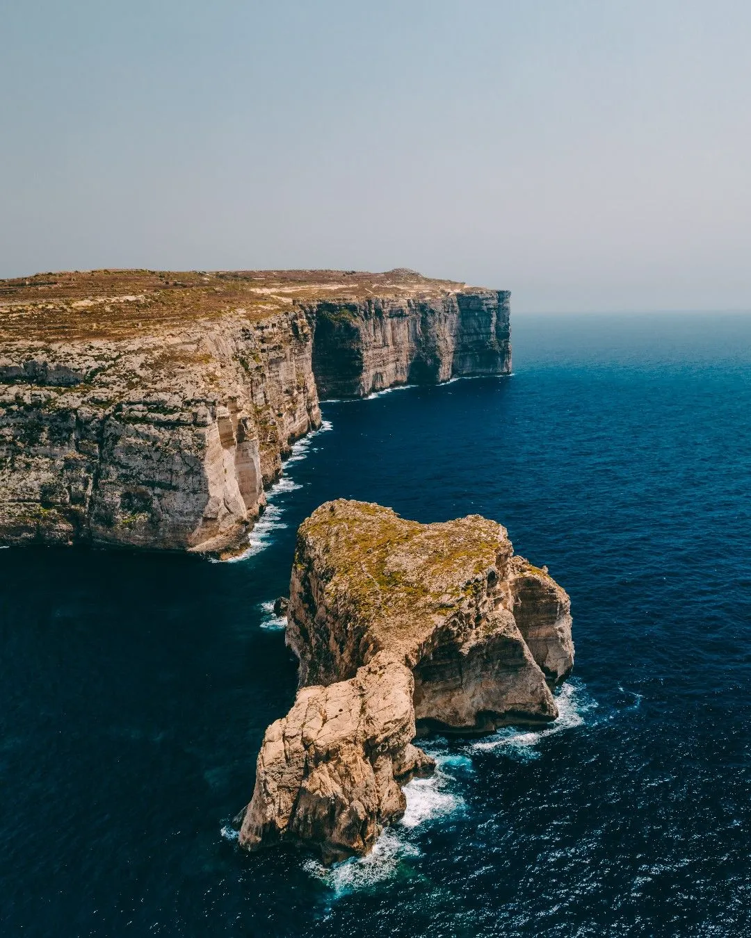
As you approach Dwejra, the landscape transforms. Huge sinkholes and circular lagoons define the area. The massive Fungus Rock stands guard at the bay entrance.
This rock was once protected by the Knights of Malta. They believed a rare fungus with medicinal powers grew only here. Trespassing then carried a death penalty.
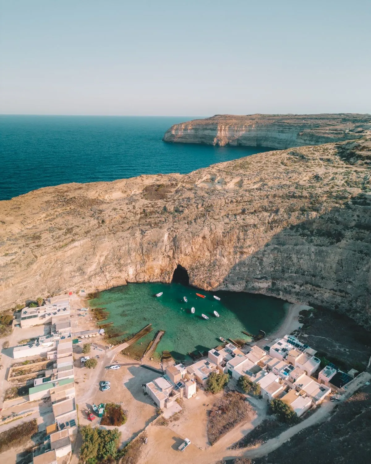
Explore the Inland Sea next. This is a secluded lagoon linked to the open ocean by a narrow tunnel. Local fishermen offer boat trips through the cave for a small fee.
| Trail Milestone | Distance | Top Feature |
|---|---|---|
| Xlendi to Sanap Cliffs | 2.0 km | Vertical Cliff Views |
| Sanap to Ta’ Sarraflu | 1.5 km | Natural Pond |
| Sarraflu to Dwejra Bay | 2.0 km | Inland Sea & Rock Formations |
When you finish your trek, look for the 311 bus. It departs regularly from the Dwejra car park back to Victoria. Tickets cost about two euros for a single trip.
Planning these small costs is essential for any explorer. Learn how to build a travel budget to keep your Mediterranean adventures sustainable.
Always respect the environment by staying on marked trails. Avoid picking any local flora. This helps preserve the delicate ecosystem for future hikers on Gozo.
Coastal Trail Highlights: Xlendi to Dwejra
- The route features the 130-meter high Sanap Cliffs, where caution is needed due to crumbly and unstable limestone edges.
- A detour to Ta’ Sarraflu reveals a rare natural freshwater pond that serves as a lush oasis for ducks and frogs.
- Dwejra Bay showcases unique geological wonders including Fungus Rock and the Inland Sea lagoon, which is accessible via a natural tunnel.
- Essential preparation includes carrying at least two liters of water and monitoring Gozo weather before traversing the remote terrain.
🌲 Dwejra Bay
Free
Geological Wonderland: A unique landscape defined by huge sinkholes, circular lagoons, and prehistoric fossils.
- Massive sinkholes and lagoons
- Embedded ancient sea fossils
- Start/End point for coastal trails
🏛️ Fungus Rock
Free
Protected Limestone Stack: A massive limestone stack famously protected by the Knights of Malta for its rare medicinal fungus.
- Guarded historically by the Knights of Malta
- Home to a rare medicinal plant
- Distinctive geological landmark
🌲 Inland Sea
Boat: ~€5
Secluded Lagoon: A quiet lagoon connected to the open Mediterranean through a narrow natural rock tunnel.
- Narrow tunnel cave access
- Fisherman-led boat trips
- Secluded swimming area
Dwejra to Wied il-Ghasri: Salt Pans and Scenic Coastal Gorges
Starting at Dwejra, you feel the raw power of the Mediterranean. The scent of salt spray fills the air near the Inland Sea. This is a prime spot for stunning travel photos.
The terrain here is rugged. Limestone formations resemble a lunar landscape. Watch your step on the jagged rocks. The path leads north along the towering cliff edges.
Start
Depart from Dwejra Bay
Take Bus 311 to reach the starting point.
8.0 km
Rugged Terrain Trek
Moderate difficulty due to uneven limestone surfaces.
Finish
Swimming in Għasri Gorge
The top activity for cooling down after the hike.
The Dramatic Cliffs of Dwejra
Follow the cliff edge toward the north. You will pass Fungus Rock. This massive limestone stack stands guard over the bay. It has a unique history tied to the Knights of Malta.
Keep an eye out for fossils embedded in the rock. The ground is rich with ancient sea life. This section requires sturdy boots due to the uneven and sharp stone surfaces.
Gozo’s north coast offers some of the most spectacular limestone scenery in the Mediterranean, where the land meets the sea in dramatic vertical drops.
Paddy Dillon, Walking on Gozo (Cicerone Press)
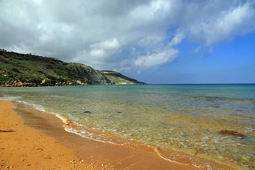
Wied il-Għasri: A Hidden Inland Fjord
Wied il-Għasri is a winding gorge. The narrow inlet leads to a tiny pebble beach. It is perfect for a cooling dip after a long trek through the sun.
The water here is crystal clear. You can hear the echoes of the waves against the cliff walls. It is much quieter than the famous spots recommended for hiking to avoid crowds in other parts of Europe.
Wied il-Għasri is a secret sanctuary where the turquoise sea carves a path deep into the Gozitan heartland.
🌲 Wied il-Għasri
Free
Hidden Inland Fjord: A winding coastal gorge that leads to a tiny, quiet pebble beach between high walls.
- Crystal clear turquoise water
- Narrow winding sea gorge
- Quiet pebble beach for swimming
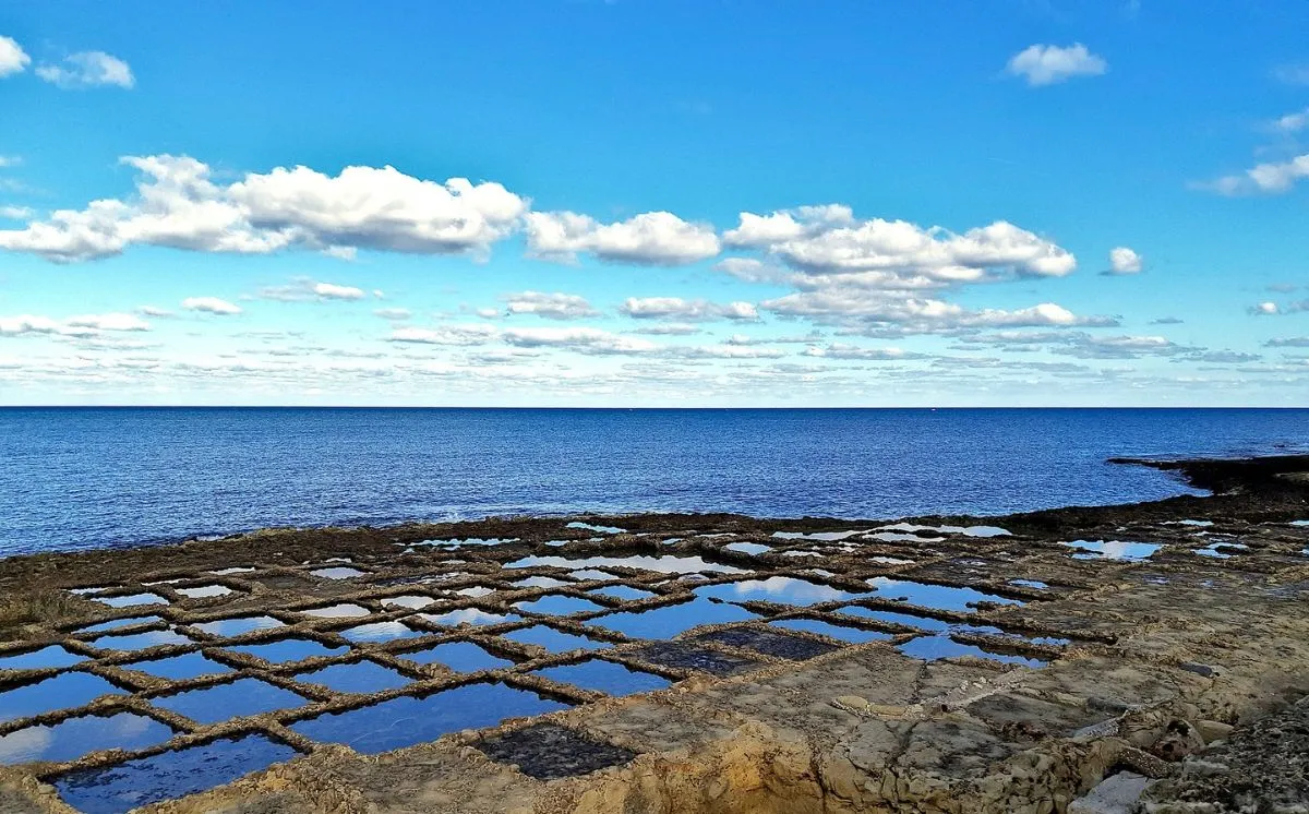
The Xwejni Salt Pans: A Living Heritage
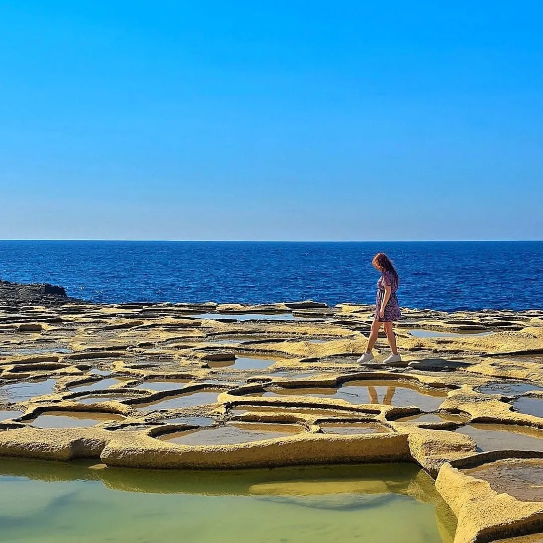
Near Xwejni, the coast flattens into salt pans. These geometric pools have been used for centuries. Local families still harvest salt here using traditional methods.
The patterns of the pans are mesmerizing. They reflect the sky like small mirrors. This area marks the transition from wild cliffs to the quiet town of Marsalforn.
Review the logistics for this specific stretch of the trail below to ensure a safe journey:
| Feature | Details |
|---|---|
| Distance | Approximately 8 Kilometers |
| Difficulty | Moderate (Rugged Terrain) |
| Best Transport | Bus 311 to Dwejra |
| Top Activity | Swimming in Għasri Gorge |
Respect the local environment by staying on marked paths. Avoid walking directly on the salt pans to protect the harvest. Carry all trash back to the town centers.
Highlights of the Dwejra to Wied il-Ghasri Trail
- Trek across the rugged lunar landscape of Dwejra, keeping an eye out for prehistoric fossils and the historic Fungus Rock.
- Descend into the secluded Wied il-Ghasri gorge to enjoy a swim in a narrow, crystal-clear inland fjord away from the crowds.
- Walk past the Xwejni Salt Pans to witness traditional salt harvesting in geometric pools carved into the limestone coast.
- Prepare for sharp and uneven terrain by wearing sturdy hiking boots for the steep cliffside paths.
🎨 Xwejni Salt Pans
Free
Traditional Salt Heritage: Geometric pools carved into limestone used by local families for centuries to harvest sea salt.
- 350-year-old geometric pools
- Traditional salt harvesting methods
- Sky-mirroring limestone pans
Marsalforn to Ramla Bay: Exploring the Red Sand Shoreline
Begin your trek at the vibrant harbor of Marsalforn. The scent of fresh sea salt and grilled seafood greets you at the water’s edge.
Walk west toward the iconic Xwejni Salt Pans. These geometric pools have been carved into the limestone for over 350 years.
The landscape here is surreal and stark. You will see local families still harvesting salt crystals under the intense Mediterranean sun.
Hiking Gozo’s coast is like walking through a living postcard of salt, stone, and sapphire sea.
🍽️ Marsalforn
$
Vibrant Harbor Town: A lively seaside town known for its harbor views and fresh grilled seafood.
- Scent of fresh grilled seafood
- Vibrant harbor atmosphere
- Coastal promenade walk
The Rugged Cliffs of Ghajn Barrani
Leave the flat pans behind as the trail ascends. The path becomes a narrow dirt track winding through wild thyme and fennel bushes.
This stretch offers some of the best scenic trail views on the island. The blue horizon feels endless from the cliff tops.
Be careful near the edges as the limestone is fragile. Always stay on the marked path to protect the local flora and your safety.
You may encounter local farmers tending to small terraced fields. Respect their privacy and stick to the established coastal route.
The clay slopes of Ghajn Barrani are ecologically sensitive. Hikers should avoid straying off-path to prevent soil erosion.
Michelle Buttigieg, Malta Tourism Authority Representative
Descending to the Red Sands of Ramla Bay
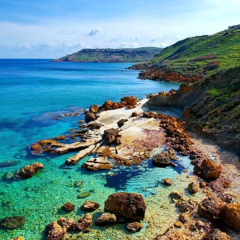
The trail eventually dips toward the valley of Ramla. Soon, the famous burnt-orange shoreline of Ramla l-Hamra comes into full view.
This beach is a protected site. Its unique color comes from the high iron content in the surrounding globigerina limestone.
Before hitting the sand, look up toward Calypso’s Cave. Legend says the nymph Calypso kept Odysseus captive here for seven years.
For more coastal exploration, consider visiting the Roman ruins buried beneath the dunes nearby. They are often covered by shifting sands.
- Distance: Approximately 7 kilometers.
- Difficulty: Moderate with some steep inclines.
- Essentials: High-SPF sunscreen and 2 liters of water.
- Best Time: Early morning to avoid the midday heat.
Ramla Bay is the perfect place to end this leg. Cool off in the turquoise waters before catching a bus back to Victoria.
Hiking Highlights: From Salt Pans to Red Sands
- Explore the 350-year-old Xwejni Salt Pans where local families have harvested sea salt crystals for over three centuries.
- Navigate the rugged cliffs of Ghajn Barrani, staying strictly on the marked path to protect sensitive clay slopes and local flora.
- End the 7-kilometer trek at Ramla l-Hamra to experience its unique iron-rich orange sands and historic Roman ruins.
Ramla Bay to San Blas: Remote Paths and Hidden Northern Coves
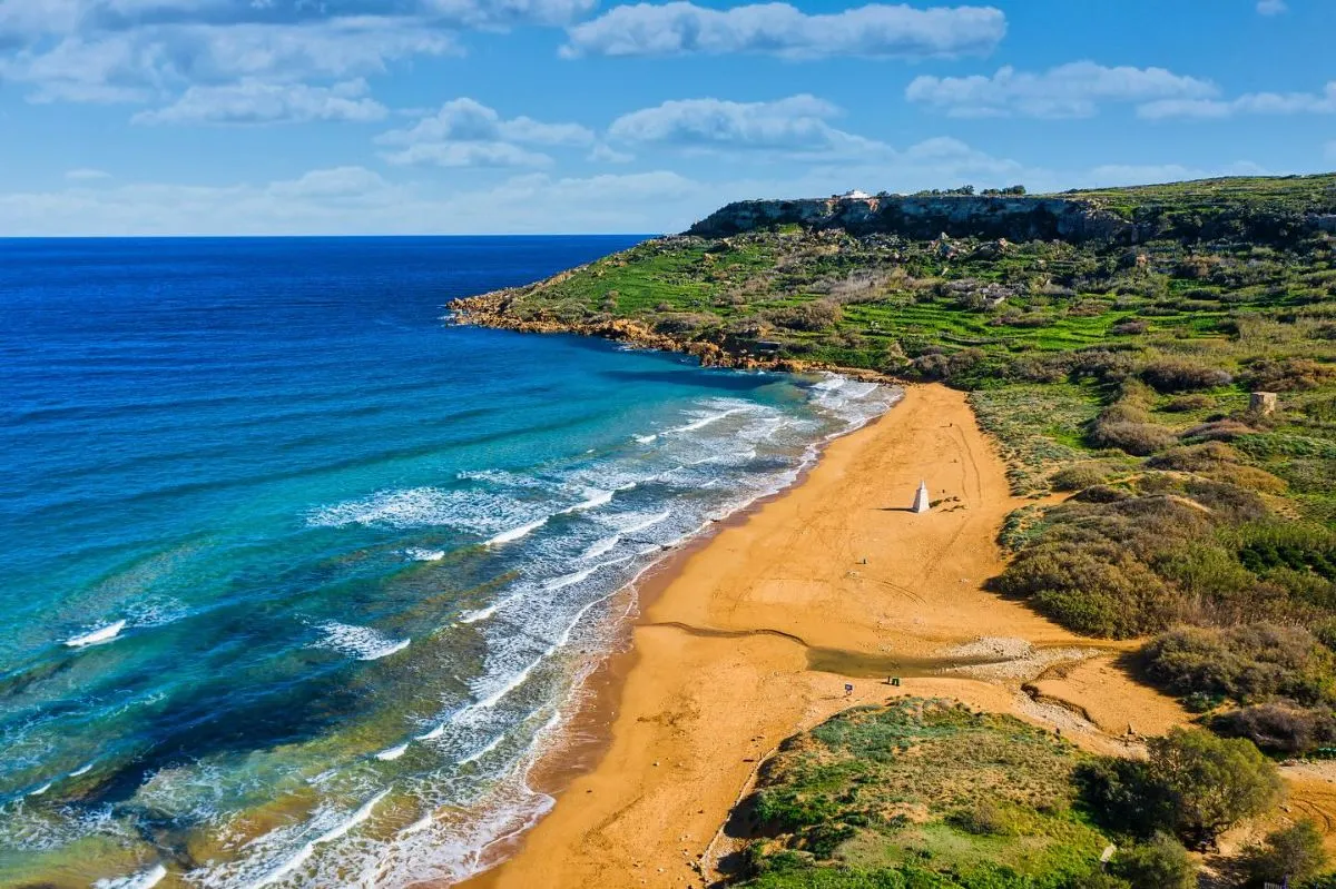
The journey begins at the famous Ramla Bay. The sand glows with a deep orange hue. You will smell the sharp salt in the air.
The Mediterranean breeze carries the scent of wild thyme. Look up toward Calypso’s Cave. This spot overlooks the entire bay.
Legend says Odysseus lived here for seven years. The path from the cave leads along the cliffs. It offers a scenic route for hikers.
Pack your gear in one of the best travel backpacks. This ensures comfort on the rocky terrain. Always carry plenty of fresh water.
The orange sands of Ramla Bay are the perfect gateway to Gozo’s wild northern soul.
Descending into San Blas Bay
The path eventually leads to San Blas Bay. This hidden gem is much smaller than Ramla. It feels very private and quiet.
The final descent is extremely steep. It requires careful footing and sturdy shoes. Local authorities often restrict car access here.
This keeps the beach peaceful for walkers. If you enjoy quiet shores, see beaches for relaxation. Both offer a calm atmosphere.
The bay of San Blas is a mini-Ramla, but it is much quieter and harder to reach by foot.
Victor Paul Borg, The Rough Guide to Malta
Always wear a hat and use sunblock. There is very little shade on the cliffs. Carry at least two liters of water.
Respect the local environment at all times. Do not leave any trash behind. Stick to marked trails to protect flora.
| Trail Feature | Details |
|---|---|
| Total Distance | Approximately 4 kilometers |
| Terrain Type | Rocky cliffside and clay paths |
| Difficulty Level | Moderate (Steep at San Blas) |
| Highlights | Red sand, caves, and terraces |
The trail passes through ancient terraced fields. You will see traditional dry stone walls. They have stood for many centuries.
In spring, the cliffs are covered in flowers. The colors of the sea are bright. It is an authentic Gozitan experience.
Exploring the Northern Coast: Ramla to San Blas
- The 4km moderate trail connects the iconic orange sands of Ramla Bay to the secluded, steep-descent ‘hidden gem’ of San Blas Bay.
- Hikers can explore legendary sites like Calypso’s Cave and walk through ancient terraced fields bounded by traditional dry stone walls.
- Essential preparation includes carrying at least two liters of water and wearing sturdy footwear for the rocky clay paths and steep final descent.
- San Blas remains a quiet sanctuary due to restricted car access, rewarding hikers with a peaceful atmosphere and unique red sands.
Embrace the Wild Spirit of Gozo
Hiking Gozo is a sensory dance. You feel the grit of limestone underfoot and the salt on your skin as you navigate these ancient paths.
From the heights of Ta’ Ċenċ to the emerald waters of Xlendi, the island reveals its soul one step at a time.
Pack your gear, respect the cliffs, and let the Mediterranean wind guide your restless spirit. These scenic coastal trails are waiting for you.
Planning Your Coastal Trek
Spring and autumn are ideal. The weather is mild, wildflowers bloom, and you avoid the intense, dehydrating heat of the peak summer months.
Always stay on marked paths. The limestone can be crumbly and unstable. Strong winds are common, so never stand too close to the drop-off.
Sturdy trail shoes or hiking boots are highly recommended. The terrain is rocky, uneven, and often sharp, requiring reliable grip and ankle support.
This hike usually takes 3 to 4 hours. The timing depends on your pace and how many times you stop to admire the dramatic coastal vistas.
