Table of Contents
- Breakneck Ridge: The Ultimate Metro-North Scramble
- Mount Beacon: Steep Climbs and Historic Fire Tower Views
- Appalachian Trail Station: Hiking the Great Swamp Boardwalk
- Anthony’s Nose: Quick Summit Overlooking Bear Mountain Bridge
- Tuxedo to Harriman State Park: Extensive Trails via NJ Transit
- Ready to Trade Concrete for Cliffs?
- Trekking Intel: Your Top Questions Answered
The concrete jungle calls for an escape, especially when summer’s vibrant energy beckons.
Imagine trading the city’s hustle for the exhilarating crunch of trail underfoot, the crisp scent of pine, and vistas that stretch forever.
Prepare to discover the wild heart of the Hudson Valley, easily accessible for your next great adventure.
Fear not the logistical puzzle; we’re unveiling two iconic destinations, Breakneck Ridge and Mount Beacon, both perfectly poised for car-free exploration from NYC.
Forget rental car woes and embrace the freedom of public transport, transforming your journey into part of the unfolding story.
This guide is your ticket to seamless outdoor thrills.
Anticipate panoramic views, challenging ascents, and the profound satisfaction of conquering new heights.
From the raw beauty of Breakneck’s scrambles to Beacon’s historic fire tower, each step promises discovery.
Let’s lace up those boots, pack a hearty lunch, and embark on unforgettable summer hikes, leaving the urban grind far behind.
The Scrambler’s Quick-Start Guide
- Ditch the car and take the Metro-North Hudson Line directly from Grand Central to the base of this legendary vertical ascent.
- Prepare for a high-intensity full-body challenge that requires using your hands to scramble over sun-warmed granite slabs.
- Experience the sensory thrill of panoramic views where the Hudson River stretches out like hammered silver below the peak.
- Prioritize safety with high-grip footwear and at least two liters of water to conquer the steep terrain in summer heat.
- Finish your adventure in the historic village of Cold Spring, the perfect spot for post-hike ice cream and antique browsing.
Breakneck Ridge: The Ultimate Metro-North Scramble
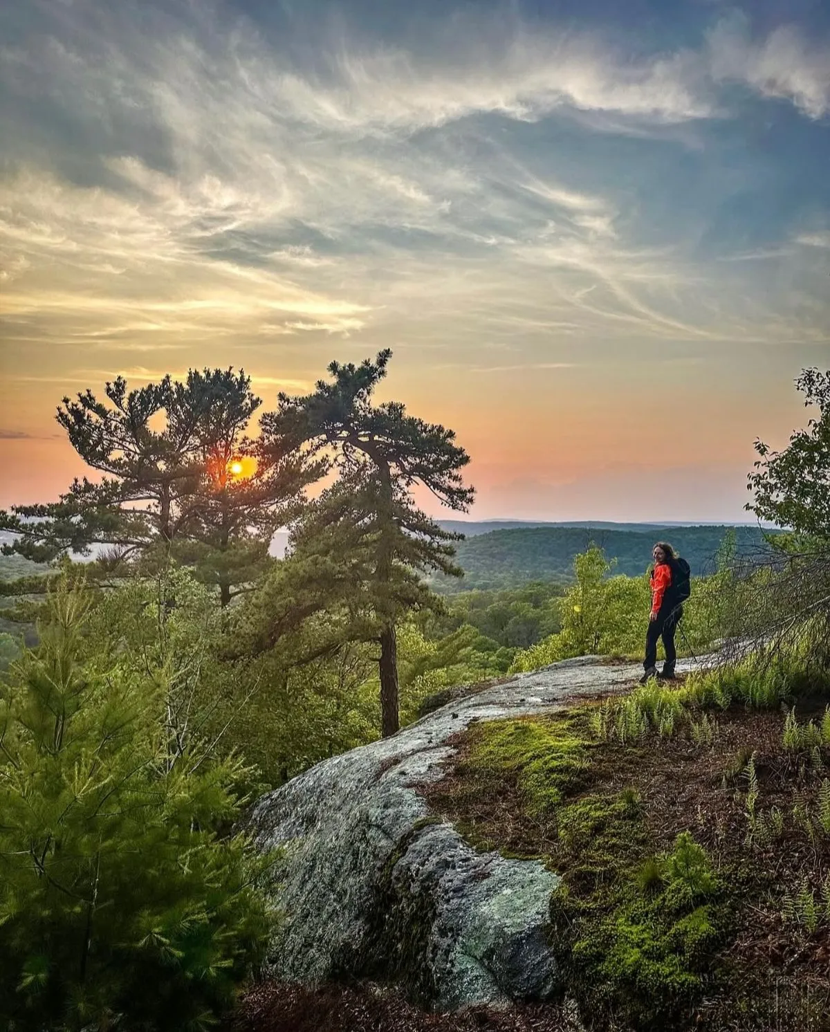
Breakneck Ridge is legendary among local adventurers for a reason. It offers an adrenaline rush that few other trails near the city can match.
This is not a casual walk in the woods. The trail demands grit and focus from the very first step. You will be using your hands to pull yourself up.
The ascent is nearly vertical in places. You scramble over massive granite slabs heated by the summer sun. It feels more like climbing than hiking.
The best views come after the hardest climbs, and Breakneck Ridge proves it with every step.
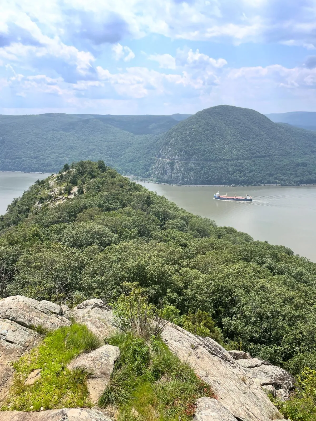
As you rise above the treeline, the Hudson River spreads out below. It looks like a sheet of hammered silver stretching toward the horizon.
You can see Storm King Mountain looming directly across the water. The wind often picks up here, cooling you down after the strenuous effort.
Breakneck Ridge is a rock scramble… You’ll need to use both your hands and your feet to pull yourself up steep sections of rock.
NY-NJ Trail Conference, Breakneck Ridge Trail Guide
🌲 Breakneck Ridge
Free
Extreme Rock Scramble: A legendary and strenuous rock scramble offering panoramic views of the Hudson River and Storm King Mountain.
- Nearly vertical granite slab ascent
- Direct Metro-North train access on weekends
- Panoramic views of the Hudson River and Storm King Mountain
Getting There and Logistics
Accessing this trailhead without a car is incredibly easy. Take the Metro-North Hudson Line from Grand Central Terminal.
On weekends, two morning trains stop directly at the Breakneck Ridge station. It is a small wooden platform located right at the trail base.
If you miss those trains, get off at Cold Spring. From there, it is a short taxi ride or a scenic 2-mile walk north to the start.
Proper gear is non-negotiable here. Wear shoes with excellent grip. Bring at least two liters of water per person during the summer heat.
8:30 AM
Metro-North Hudson Line
Depart Grand Central Terminal; check for the specific Breakneck stop.
10:15 AM
Breakneck Ridge Station
Get off at the small wooden platform at the trail base.
10:30 AM
The Vertical Scramble
Use hands and feet to navigate granite slabs; bring 2L of water.
2:00 PM
Cold Spring Village
Follow the loop trail back or walk 2 miles south to town.
Is This Hike Right For You?
Breakneck requires a high level of fitness. If you prefer water activities, check out the Best Family-Friendly Kayaking Spots on the Hudson River: Constitution Marsh & More.
Compare the intensity of Breakneck Ridge with nearby Bull Hill to decide which fits your style.
| Feature | Breakneck Ridge | Bull Hill (Mt. Taurus) |
|---|---|---|
| Difficulty | Hard / Scramble | Moderate / Hike |
| Use of Hands | ✅ Required | ❌ Not needed |
| Dog Friendly | ❌ Not safe | ✅ Yes (on leash) |
| Views | ✅ Panoramic | ✅ Scenic |
Post-Hike Rewards in Cold Spring
After conquering the ridge, your legs will likely feel like jelly. Follow the trail loop back down toward the village of Cold Spring.
This historic town is perfect for relaxing. The main street is lined with antique shops, cozy cafes, and bustling restaurants.
Grab a homemade ice cream cone near the pier. Sit by the water and watch the boats pass by before hopping on the train home.
For more regional inspiration, see our guide to 12 Best Spring Travel Destinations NYC to Explore which covers the Hudson Valley.
Breakneck Ridge: Essentials for the Ultimate Scramble
- The trail is a strenuous rock scramble that requires using both hands and feet to climb steep granite sections.
- It is conveniently accessible via Metro-North’s Hudson Line with dedicated weekend stops at the Breakneck Ridge station.
- Essential gear includes high-grip footwear and at least two liters of water to manage the intense physical effort.
- The summit offers panoramic views of the Hudson River and Storm King Mountain, making the difficult ascent worthwhile.
🎨 Cold Spring
$
Historic River Village: A charming historic town known for its antique shops, cafes, and scenic riverside pier.
- Main Street lined with antique shops and boutiques
- Scenic waterfront pier perfect for watching boats
- Variety of post-hike dining options and cafes
Mount Beacon: Steep Climbs and Historic Fire Tower Views
Mount Beacon offers one of the most rewarding cardio workouts in the Hudson Valley. This hike is famous for its steep incline and industrial history.
You begin at the base of the former Mount Beacon Incline Railway. The trail immediately greets you with a long metal staircase that sets the tone.
The steepest climbs often lead to the most unforgettable horizons.
As you ascend the Casino Trail, the sounds of the town fade away. They are replaced by the rustle of oak leaves and your own steady breath.
The path consists of steep switchbacks made of loose dirt and rock. In high summer, the canopy provides shade, but the humidity can be intense.
On a clear day, you can see the NYC skyline from the fire tower. It is a steep climb, but the 360-degree views are unbeatable.
Mike, Hike the Hudson Valley
The first plateau features the ruins of the old railway powerhouse. It is a hauntingly beautiful spot to catch your breath and hydrate.
✨ Mount Beacon
Free
Steep Cardio Hike: A challenging hike following the path of a former incline railway, known for its steep metal staircase and industrial history.
- Begins at the historic Mount Beacon Incline Railway base
- Steep switchbacks through oak canopies
- Ruins of the old railway powerhouse at the first plateau
Reaching the Fire Tower
Continue a mile past the ruins to reach the restored fire tower. The climb up the tower cab offers a true 360-degree vantage point.
Looking south, the Hudson River winds like a ribbon. You might even spot areas popular for Best Family-Friendly Kayaking Spots on the Hudson River: Constitution Marsh & More.
The breeze at the top provides relief from the summer heat. Be sure to respect the structure and wait your turn if the platform is crowded.
🗽 Mount Beacon Fire Tower
Free
360-Degree Lookout: A restored fire tower located a mile past the railway ruins offering a full 360-degree view of the region.
- Restored observation cab for safe climbing
- Views stretching to the NYC skyline on clear days
- Refreshing breeze at the high-elevation summit
Logistics and Local Vibe
Getting here is simple without a car. Take the Metro-North Hudson Line to Beacon Station. The trailhead is a walk or a free bus ride away.
- Transit: Metro-North from Grand Central (approx. 80 mins).
- Trailhead: Walking distance from Main Street or take the Beacon Free Loop G bus.
- Difficulty: Strenuous/Hard.
- Gear: Sturdy boots and plenty of water are mandatory.
After the hike, explore Main Street. It is lined with art galleries and breweries. It is one of the 12 Best Spring Travel Destinations NYC to Explore for culture lovers.
Always stay on marked trails to protect the ecosystem. The steep grade means erosion is a risk, so tread lightly and pack out all trash.
Mount Beacon: Essential Trail Notes
- A strenuous cardio workout featuring a steep metal staircase and rugged switchbacks.
- The restored fire tower provides panoramic 360-degree views and glimpses of the NYC skyline.
- Conveniently accessible for car-free hikers via the Metro-North Hudson Line and the Beacon Free Loop bus.
- The route is dotted with industrial history, including the ruins of the former Mount Beacon Incline Railway.
🛍️ Main Street Beacon
$
Art & Brewery District: A vibrant cultural hub near the Beacon train station filled with art galleries and local breweries.
- Walking distance from the Mount Beacon trailhead
- High concentration of contemporary art galleries
- Numerous local craft breweries for post-hike drinks
90 Mins
Train to Beacon Station
Take the Metro-North Hudson Line from NYC.
Start
Casino Trail Ascent
Begin at the base of the former Incline Railway staircase.
Midday
Fire Tower Summit
Climb the tower for a 360-degree view of the valley.
Afternoon
Beacon Main Street
Explore art galleries or catch the free Beacon Loop G bus.
Appalachian Trail Station: Hiking the Great Swamp Boardwalk
The Appalachian Trail Station is a unique anomaly. It is a weekend-only stop on the Metro-North line designed exclusively for hikers.
The train doors open directly onto the trail in Pawling. There is no town center here, just the immediate embrace of the wild.
Stepping off the platform, the sensory shift is instant. The roar of the city is replaced by the hum of cicadas and rustling leaves.
The air smells of damp earth and sweet wildflowers. This section of the trail offers a diverse mix of wetlands and hardwood forests.
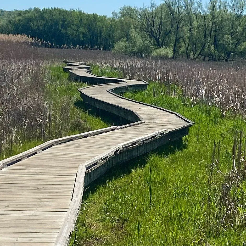
Your journey begins with the Great Swamp. Wooden boardwalks, known as puncheons, guide you safely over the muddy, water-logged terrain.
From the subway to the swamp in under two hours; nature is closer than you think.
The flat start is deceivingly easy. It is an approachable route for beginners or those learning how I overcame my fear & took my first solo trip.
Sunlight filters through the canopy above the swamp. Ferns carpet the forest floor, creating a prehistoric atmosphere deep in the woods.
🗽 Appalachian Trail Station (Pawling)
Free
Hiker-Only Train Stop: A unique weekend-only Metro-North stop that drops hikers directly into the wilderness of Pawling.
- Only operates on Saturdays and Sundays
- Direct access to the Appalachian Trail from the platform
- Surrounded by immediate nature and cicada sounds
🌲 The Great Swamp
Free
Wetland Boardwalk: A prehistoric-feeling wetland area navigated via wooden puncheon boardwalks.
- Extensive wooden boardwalk system (puncheons)
- Lush floor carpeted with ferns
- Diverse ecosystem of damp earth and wildflowers
The Climb to Cat Rocks
After the wetlands, the trail demands effort. The path turns upward, leading hikers on a steep scramble toward the Cat Rocks overlook.
This ascent requires sturdy footwear. You will navigate roots and rocky outcrops as you gain elevation above the valley floor.
The summit offers one of the best views in the region. You can see miles of rolling farmland and the distant outline of the Catskills.
It is a breathtaking spot for a lunch break. The scenery provides a perfect opportunity for practicing how I took stunning travel photos with just a camera.
The Appalachian Trail is a footpath for those who seek fellowship with the wilderness.
Benton MacKaye, Appalachian Trail Conservancy
🌲 Cat Rocks
Free
Scenic AT Overlook: A rocky summit overlook on the Appalachian Trail providing views of the Catskills and local farmland.
- Steep ascent over roots and rocky outcrops
- Panoramic views of rolling farmland
- Distant views of the Catskill Mountains
Essential Logistics for the AT Stop
This hike requires careful planning due to the limited train service. Missing your return train can leave you stranded.
- Transit: Take the Metro-North Harlem Line from Grand Central Terminal.
- Schedule: The train ONLY stops here on Saturdays and Sundays. Check the MTA app.
- Water: There is NO water or bathroom at the station. Pack at least 2 liters.
- Ticks: This area is prone to ticks. Wear high socks and use repellent.
- Safety: Tell someone your plan. Cell service is spotty in the reserve.
Essential Guide to the Appalachian Trail Station Hike
- The Metro-North Harlem Line offers a rare weekend-only stop that deposits hikers directly onto the Appalachian Trail in Pawling.
- The trail begins with an accessible trek across the Great Swamp via wooden boardwalks before transitioning into a challenging forest ascent.
- A steep scramble to Cat Rocks provides panoramic views of the rolling farmland and the distant Catskill Mountains.
- Hikers must strictly adhere to the limited train schedule to avoid being stranded, as return service is infrequent.
Morning
Metro-North Harlem Line
Weekend-only train to Appalachian Trail station.
Arrival
Great Swamp Boardwalk
Step off the train directly onto the wooden puncheons.
Midday
Cat Rocks Scramble
Navigate rocky outcrops to reach the summit overlook.
Return
AT Station Platform
Must monitor the MTA app strictly to avoid missing the return train.
Anthony’s Nose: Quick Summit Overlooking Bear Mountain Bridge
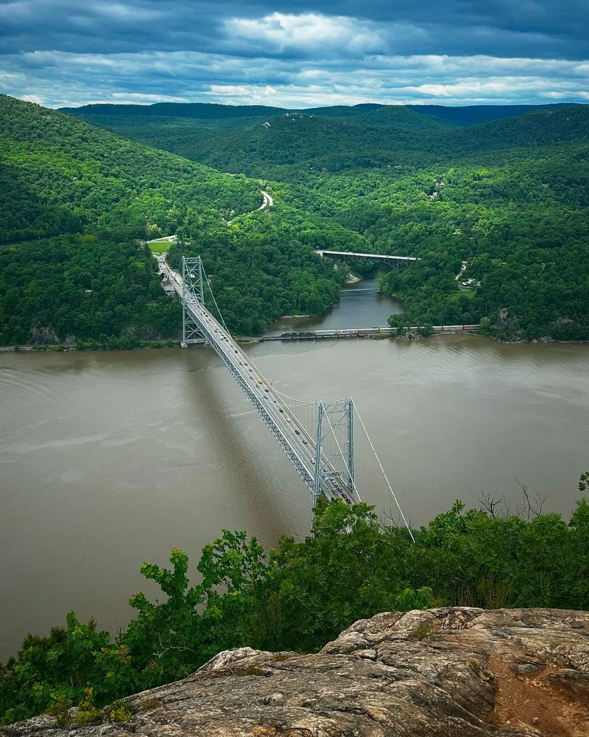
This hike offers a massive visual payoff for a moderate effort. It is famous for the bird’s-eye view of the Bear Mountain Bridge.
The trail begins with a steep, rocky ascent. It often feels like nature’s stairmaster right from the start.
Summer humidity often clings to the ferns here. Sunlight filters through the dense green canopy above you as you climb.
The best views often come after the steepest climbs, and the Hudson Valley delivers every time.
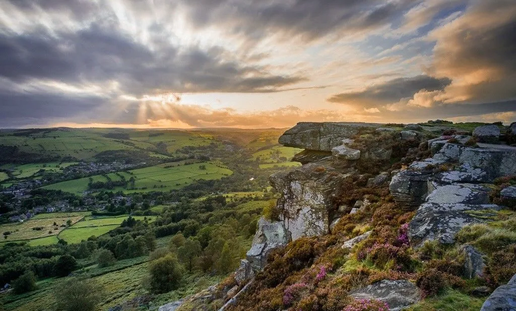
You eventually emerge onto a rocky outcropping. The wind cools your face as the trees suddenly break away.
The bridge looks like a toy structure below. You can see the river winding through the highlands for miles.
Crowds are common here on warm weekends. Start your hike early in the morning to claim a quiet spot on the rocks.
🗽 Anthony’s Nose
Free
Bridge Overlook: A moderate hike offering a spectacular bird’s-eye view of the Bear Mountain Bridge.
- Massive visual payoff for moderate effort
- Unobstructed views of the Bear Mountain Bridge
- Quick summit popular for day trips
Logistics: Getting to the Trailhead
This trail is accessible via the Metro-North Hudson Line. You have two main options depending on your desire for walking.
The Manitou station is the closest stop. However, it is a limited-service station that usually only operates on weekends.
From Manitou, you must walk along Route 9D. It is a busy road, so stay alert and walk against traffic to the trailhead.
Alternatively, take the train to Peekskill. This station has frequent service and amenities like bathrooms and cafes.
From Peekskill, catch a short Uber or taxi. It is a ten-minute ride to the trail start on the Cortlandt side.
If you enjoy this region, you might also like these beautiful spring travel destinations in USA.
| Transit Option | Availability | Walking Required |
|---|---|---|
| Manitou Station | Weekends Only | 1.5 miles (Road walk) |
| Peekskill Station | Daily Service | None (Requires Taxi) |
| Camp Smith Trail | Weekends (Manitou) | Longer hike route |
Pack plenty of water for this trip. The humidity in the Hudson Valley can dehydrate you quickly during the summer months.
Bring energy-dense snacks for the summit. You can find inspiration in our guide to easy winter hiking meals which work year-round.
While short, this trail is steep and rocky. Wear sturdy shoes and bring plenty of water, especially in summer heat.
Scenic Hudson, Anthony’s Nose Park Guide
Always respect the local environment. Carry out all your trash to keep these popular trails clean for future hikers.
Anthony’s Nose Hiking Essentials
- Expect a steep, rocky ascent nicknamed ‘nature’s stairmaster’ that leads to a famous bird’s-eye view of the Bear Mountain Bridge.
- Arrive early on warm weekends to secure a spot on the rocky outcropping and beat the heavy crowds.
- Choose between the weekend-only Manitou station for a 1.5-mile walk or the daily Peekskill station for a quick taxi ride to the trailhead.
- Carry extra water and energy-dense snacks to stay hydrated and fueled in the humid Hudson Valley environment.
Tuxedo to Harriman State Park: Extensive Trails via NJ Transit

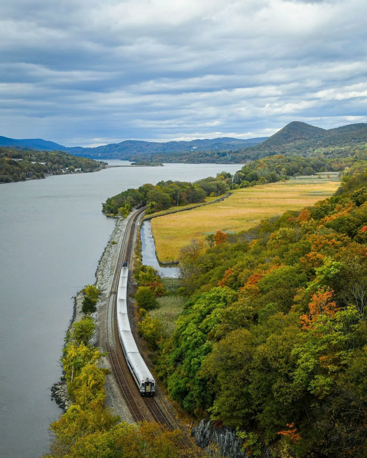
The train ride to Tuxedo is part of the adventure. You leave the concrete canyons of Manhattan behind as the scenery shifts to lush river valleys.
Boarding the NJ Transit Port Jervis Line at Penn Station feels like an escape. The rhythmic clatter of the tracks soothes the frantic city energy.
You will arrive at the historic Tuxedo Station in about an hour. The stone architecture gives the town a charming, old-world atmosphere.
The air here smells of damp earth and pine needles. It is a refreshing shock to the senses compared to the humid subway platforms of the city.
Trade the subway screech for the forest silence. Harriman is the exhale every city dweller needs.
From the station, the trailhead is just a short walk away. You do not need a car to access the deep wilderness of the Ramapo Mountains.
Top Trails accessible from Tuxedo
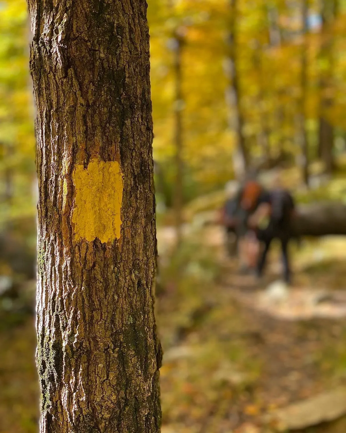
Harriman State Park is a labyrinth of over 200 miles of trails. The options range from grueling vertical scrambles to peaceful forest meanders.
Choosing the right path is crucial for a day trip. You want to maximize your time in nature without missing the return train.
Here are the best routes starting near the train station:
- Ramapo-Dunderberg Trail: This is the oldest trail in the park. Expect steep climbs and sweeping views of the Tuxedo valley.
- Kakiat Trail: A slightly more moderate option. It winds through diverse woodlands and offers great opportunities for birdwatching.
- Triangle Trail: Ideal for loop hikes. It connects with other paths to create a custom itinerary based on your energy levels.
Proper nutrition is vital for these inclines.
While these snacks are great for cold weather, see our guide on 10 Easy Winter Hiking Meals for Warmth & Strength.
Its fueling principles apply year-round.
Summer hiking here means vibrant greenery. The canopy of oak and maple trees provides welcome shade during the hottest part of the afternoon.
Always carry a map and compass. Trail blazes can be hard to spot, and cell service is often unreliable in the park’s interior.
New York-New Jersey Trail Conference, NYNJTC Hiking Safety
Safety is paramount when hiking solo or in groups. The terrain is rugged, and weather can change quickly in the Hudson Highlands.
Always tell someone your route before you leave. For more advice on independent travel, check our guide on 27 Inspiring USA Trips for Solo Female Travelers.
Keep an eye on the time as you hike. The trains back to NYC run infrequently on weekends, so knowing the schedule is mandatory.
Essential Guide to Harriman via Tuxedo Station
- Reach the historic Tuxedo Station from Penn Station in about an hour via the NJ Transit Port Jervis Line.
- Explore over 200 miles of diverse trails, including the steep Ramapo-Dunderberg and the birdwatcher-friendly Kakiat Trail.
- Access the mountain wilderness directly from the station on foot, making a car entirely unnecessary for the trip.
- Prioritize safety by carrying a physical map and compass, as cell service is unreliable throughout the park’s interior.
Ready to Trade Concrete for Cliffs?
Escaping the city’s hum doesn’t require a set of keys. These trails offer wild vistas and physical challenges just a train ride away.
Pack your boots and go. From the granite scrambles of Breakneck to the charming streets of Cold Spring, your next adventure awaits on the Hudson Line.
Breathe deep; the mountains are calling.
Trekking Intel: Your Top Questions Answered
It is quite steep and requires using hands. If heights make you nervous, Bull Hill is a better, more gradual alternative with similar Hudson River views.
Metro-North runs daily, but the Breakneck station is weekend-only. On weekdays, get off at Cold Spring and walk or take a quick taxi to the trailhead.
Bring at least 2 liters of water, sturdy hiking shoes, sunscreen, and a portable charger. Pack a light snack to enjoy at the summit for a perfect reward.
Most trails are well-marked. Following the loop back to Cold Spring is straightforward and leads you right toward the local shops and the train platform.
